Our Product Suite
Advanced geospatial tools designed for rural lending, planning, and administration.
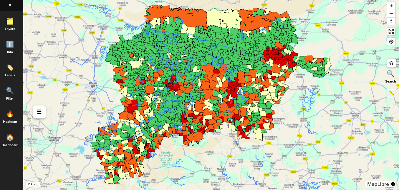
Map View
Interactive Land Visualization
Dynamic map interface allowing users to filter, rate, and compare land units with ease and precision. Features include Agricultural Suitability Indices, Water Endowment ratings, and vulnerability heatmaps for entire districts.
Data-Driven Analytics
Analyze crop-specific risks with detailed graphs, such as Soybean water demand vs. Daily Rainfall. Identify trends in temperature-based demand and precipitation to assess yield vulnerability.
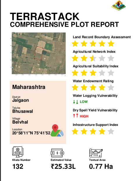
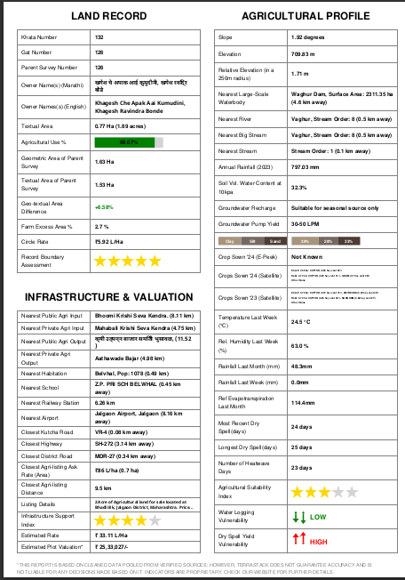
Plot Reports
Comprehensive Scoring
Get a granular "Credit Score" for land. Our reports provide 5-star ratings for Agricultural Network Index, Suitability Index, and Water Endowment, giving a clear snapshot of asset quality.
Risk & Value Assessment
Instantly identify critical risks like Water Logging and Dry Spell Vulnerability. Includes estimated plot valuation (e.g., ₹118L) and detailed boundary assessments for lenders and insurers.
Other Projects
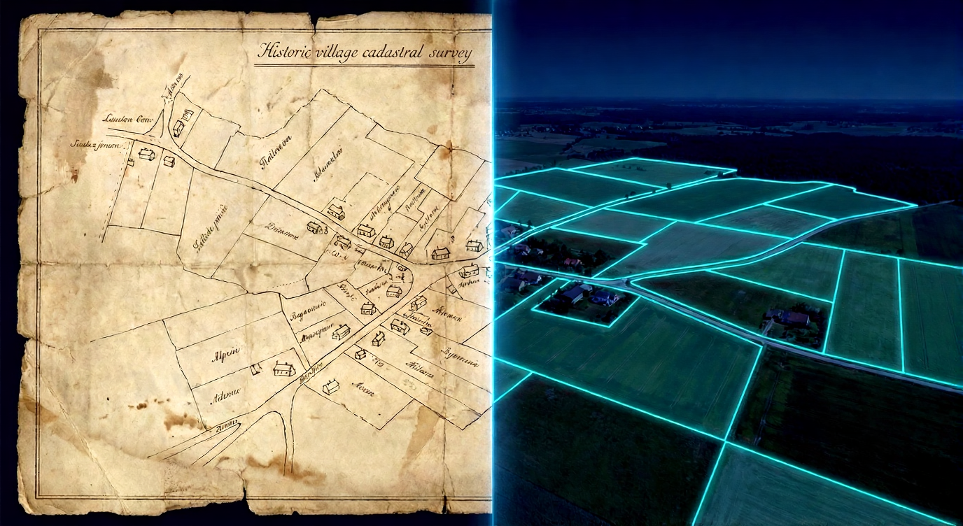
Land Records Modernization
Aligning cadastral (ownership) maps with satellite imagery to judge and improve accuracy of land records.
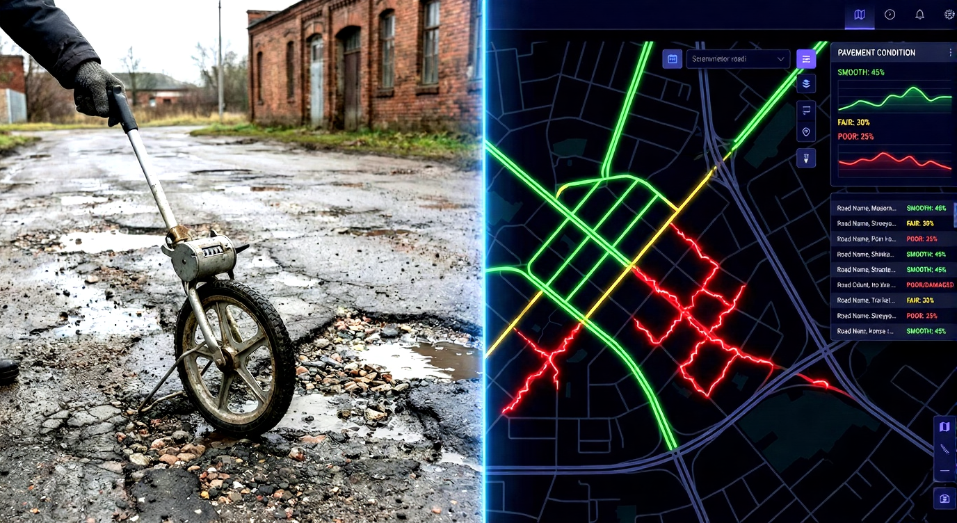
Pavement Condition Interface
Using mobile sensors to measure road conditions in rural Maharashtra for better planning.
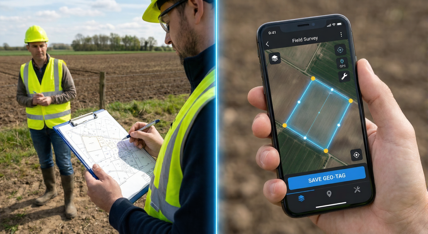
Field Survey Assistance
A mobile application for surveyors to digitally map land assets in the field.