Operation Dronagiri
Terrastack – Rural Land Intelligence
Powered by the Geo-Intel Lab, IITTNiF, Terrastack integrates climate stress and agricultural productivity analytics at the land-parcel level.
Problem Statement
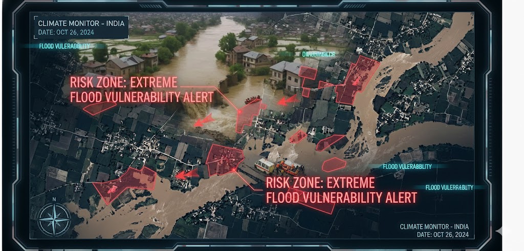
Vulnerability Identification
How to identify farmers most vulnerable to dry and wet spells?
Targeted Support
Which farmers are in most need of targeted DBT and support schemes?
Resource Planning
How to guide better water and energy planning using village-level insights?
Our Solution
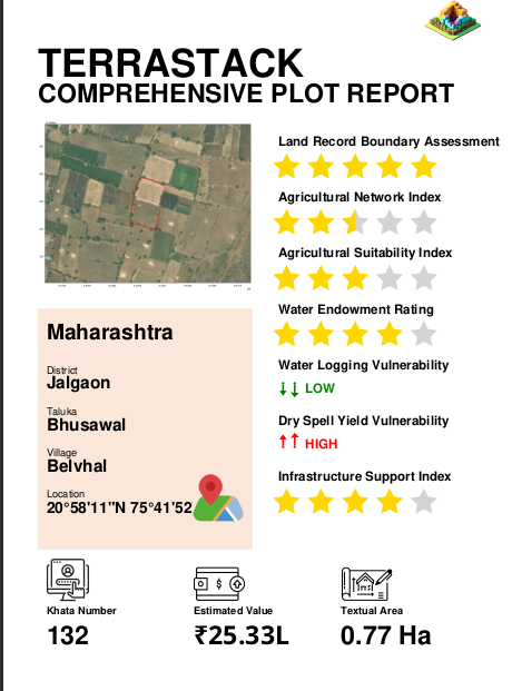
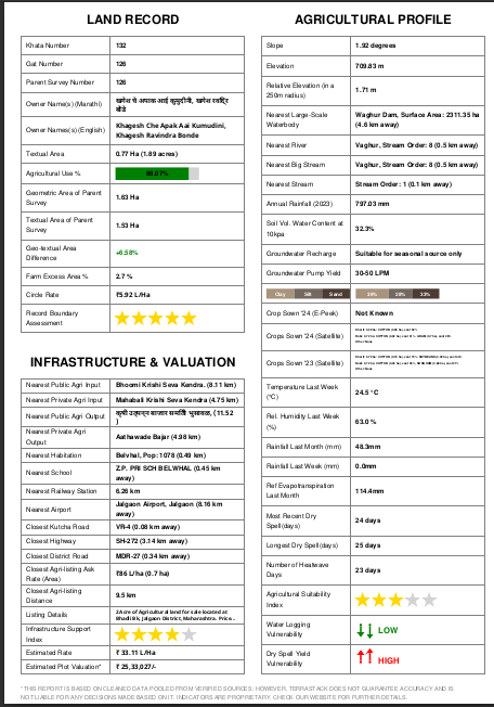
Plot Reports
Granular assessment of land, crop, and climate factors to identify farmers vulnerable to droughts and floods. Ideal for institutions seeking farm-level insights to target DBT support, evaluate creditworthiness and provide insurance.
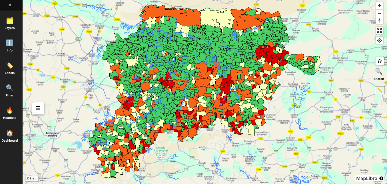
Map View
Plot/village-level visualization of drought, flood, and crop vulnerability through dynamic heatmaps and statistics. Ideal for policymakers, lenders, and administrators seeking clear, data-backed insights to identify at-risk farms.
Accelerator
Geospatial Innovation Accelerator (GIA)
SINE, IIT Bombay
Pilot District
Washim, Maharashtra
Status: Ongoing
Alignment with National Vision
These product interfaces have been designed in alignment with Operation Dronagiri, showcasing the use of geospatial data for agricultural resilience and digital governance. They contribute directly to the vision of Viksit Bharat 2047 through data-driven rural intelligence.
VIEW OUR PRODUCTSMedia Mentions
Expected Impact
- Impacting 12,000+ farmers across pilot regions
- Coverage of 10,000+ farm parcels
- Improve accuracy of beneficiary ID by over 15%